Yellowstone National Park - June 2008
Grand Loop Tour - June 9
NOTE: Click on any of the images except the map for a larger photograph.
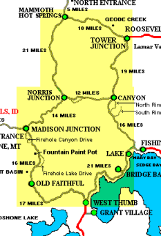
The next day was GLORIOUS!! We awoke at 6 am to bright blue skies and a few pretty white clouds. Breakfast at the Snow Lodge, then we headed out to take the Grand Loop Tour which covers 142 miles. However, part of the road was still closed (Roosevelt to Canyon) because of the threat of avalanches and fallen trees. We figured we would have to do some backtracking.
The magnificent day was our reward for the snow and cold and rain of the past week. It was a gift for us to enjoy. That morning, as we drove from the Old Faithful area to Madison Junction and then on to Norris, we were amazed that all of the snow had vanished. Hardly a trace was left, and the fairyland of snow-draped trees was gone. It was a totally different look than we had seen over the previous couple of days.
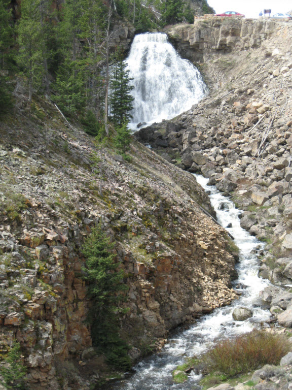
Our first planned stop was the Mammoth Hot Springs area but we would stop at spots along the way for more photos of the snow covered peaks in the distance, the Gibbon River and Gibbon Falls. We passed Roaring Mountain, named for the loud hissing and burning of steam vents which could be heard up to 4 miles away. Roaring Mountain is a barren, furrowed, white ridge, rising 400 feet from the base. The mountain side is spotted with steam vents or fumaroles, and the fumaroles' vents are rimed with bright yellow, crystalline sulfur deposits. The leaching of sulfuric acid has produced the stark, barren environment. Now, it is nothing but quiet.
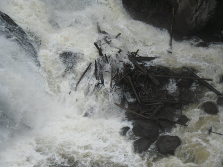
Debris at the bottom of Gibbon Falls
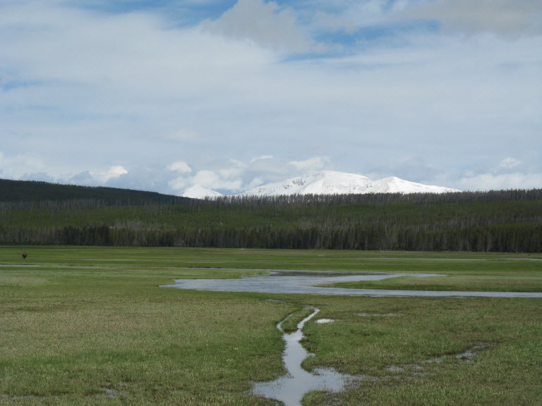
Meadow area with snow capped mountains

Roaring Mountain
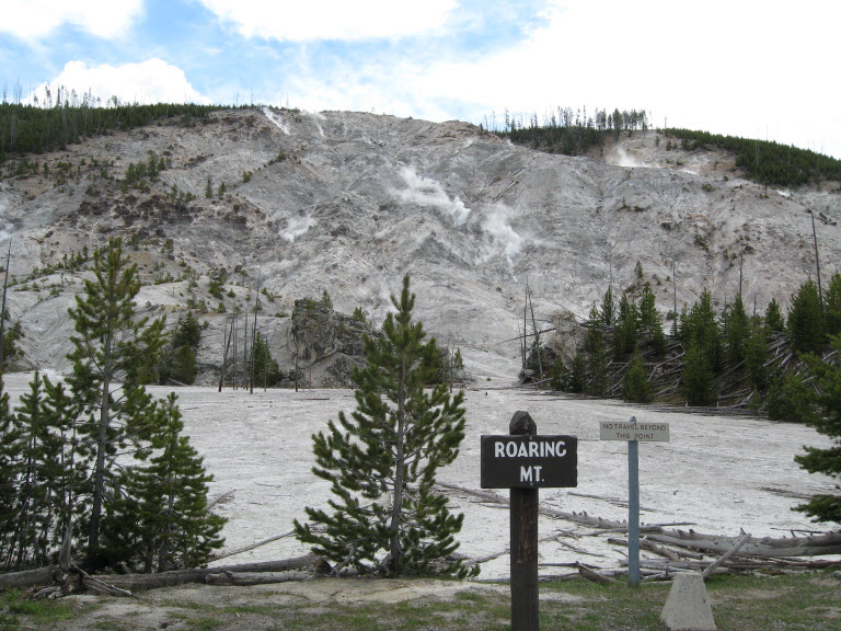
Roaring Mountain
Across the road from Roaring Mountain, we could see an area that had been burned in the fires of 1988 and had been re-seeded. Lodgepole pines have thin bark and are easily killed by fire. They grow densely so the fire is easily spread, BUT fire is part of the ecosystem. The old trees are removed by fire. The seeds of lodgepole pines require fire to open and cause the young forest to grow again. Eventually spruce and fir take their place and a mature forest results. Scattered around like jewels, glacier lilies adding a bright spot of color. We came upon more bison on the road, creating their usual traffic jam. And, it seemed, there was a picture around every corner.
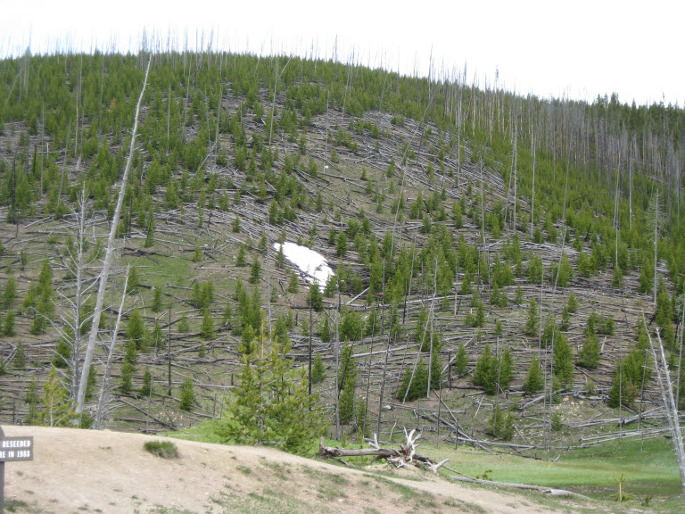
Lodgepole Pine forest reseeded after the 1988 fires.
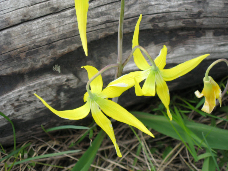
Glacier Lily
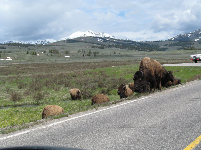
Bison on road
Approaching Mammoth Hot Springs.
By now our morning coffee was taking it's toll, so at Mammoth Springs we headed for the visitor's area for a pit stop and lunch. We had packed our lunch, so we ate in the car, watching all the people. We made a short stop at the visitor center, where we found out the road from Roosevelt to Lake Junction had just reopened. Great news! We would be able to make the full loop.
We retraced our steps to the Upper Terrace Road and got out to walk one of the boardwalks, the trail to Canary Spring. Jim was beginning to feel not so hot, so we limited our walking around. One nice thing about a digital camera is, one can take all of the shots wanted and have just those printed that are really liked. We took a lot.
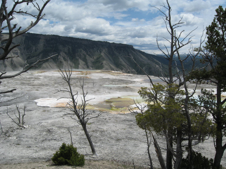
Upper Terrace Mammoth Hot Springs
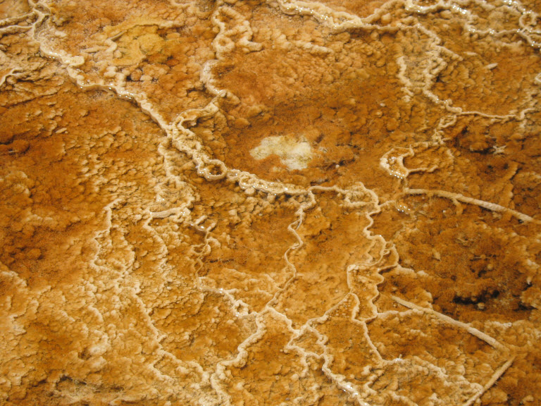
Looking into water on the Canary Spring Trail
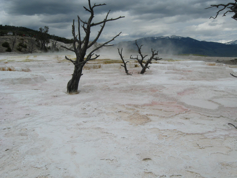
Mammoth Hot Springs Upper Terrace
Continue the Grand Loop Adventure